Sale on canvas prints! Use code ABCXYZ at checkout for a special discount!


The watermark at the lower right corner of the image will not appear on the final product.

by Paul Fearn
$28.00
Design Location
Color
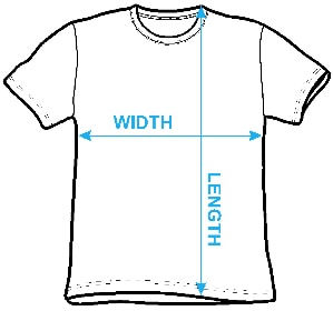
Image Size
Product Details
Our Bella / Canvas t-shirts are made from a 50% cotton / 50% polyester blend and are available in five different sizes. All t-shirts are machine washable.
Design Details
A beautiful example of Zannoni's 1762 map of the West Indies, Florida and Central America. Covers from the Gulf of Mexico to the lesser Antilles... more
Ships Within
1 - 2 business days
A beautiful example of Zannoni's 1762 map of the West Indies, Florida and Central America. Covers from the Gulf of Mexico to the lesser Antilles including all of the West Indies, Florida and Central America, with parts of Louisiana, Mexico and northern South America. In essence a nautical chart, this map has little inland detail and is crisscrossed with both rhumb lines and lines of latitude and longitude. Coastal cities, rivers and ports are named throughout. Also shows numerous shoal, reefs, and other offshore dangers. Southern Florida is rendered as an archipelago in a primitive attempt at describing the Everglades. Drawn by A. Zannoni in 1762 for issue as plate no. C 32 in Jean Lattre's 1776 issue of the Atlas Moderne .
My passion is Photography and Aviation or is that Aviation and Photography ! I hope you enjoy my photographs.
$28.00


Dean Wittle
Congratulations on your sale!
Jon Burch
Congratulations on your $ale
Linda Bailey
Paul, congrats on your sale!
Dale Jackson
Congratulations!
Andre Theophane SITCHET-KANDA
Congratulations on your sale, Paul.
Lazaro Hurtado
congrats!