Sale on canvas prints! Use code ABCXYZ at checkout for a special discount!


by Paul Fearn
$48.00
Design Location
Color
Image Size
Product Details
Our hoodies are made from a 75% cotton / 25% polyester blend and are available in five different sizes. All hoodies are machine washable.
Design Details
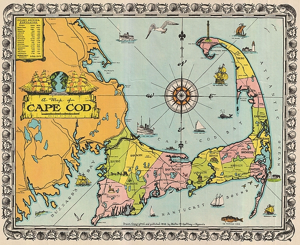
This unusual map of Cape Cod was drawn in 1932 by the Cape Cod architect Walter M. Gaffney. . This particular map was drawn by Hyannis architect... more
Ships Within
1 - 2 business days
This unusual map of Cape Cod was drawn in 1932 by the Cape Cod architect Walter M. Gaffney. . This particular map was drawn by Hyannis architect Walter M. Gaffney during the Great Depression. According to his daughter, Gaffney issued this map to make supplemental money while the architecture business suffered a downturn. This is considered a figurative map or a decorative map, and reflects a style that first began to appear around 1910. As a map its intention is not so much to provide direction as to illustrate the character, famous places, and historical appeal of Cape Cod. Cartographically speaking, this map style most likely draws its inspiration from late 19th century tourist maps and railroad maps. Tourist Maps, common to major cities in Europe (usually Paris or London), included profiles of notable buildings and monuments and were designed to help foreign tourists identify and navigate to the most important sights. Railroad Maps are a related genre more common to the United State...
My passion is Photography and Aviation or is that Aviation and Photography ! I hope you enjoy my photographs.
$48.00


There are no comments for 1932 Walter M Gaffney Map of Cape Cod Massachusetts . Click here to post the first comment.