Sale on canvas prints! Use code ABCXYZ at checkout for a special discount!


The watermark at the lower right corner of the image will not appear on the final product.

by Paul Fearn
$48.00
Design Location
Color
Image Size
Product Details
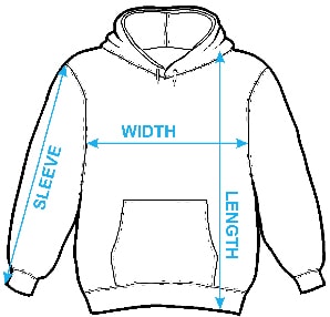
Our hoodies are made from a 75% cotton / 25% polyester blend and are available in five different sizes. All hoodies are machine washable.
Design Details
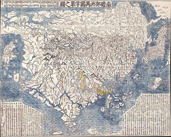
A seminal map. This is the first Japanese printed map to depict the world, including Europe and America, from a Buddhist cosmographical perspective.... more
Ships Within
1 - 2 business days
A seminal map. This is the first Japanese printed map to depict the world, including Europe and America, from a Buddhist cosmographical perspective. Printed by woodblock in 1710 (Hoei 7), this map was composed by the Buddhist monk Rokashi Hotan. Inspired by the 1653 publication of Si-yu-ki, a pilgrimage narrative of the Chinese monk Hsuang-Tsang's (602-604) travels to India in search of sacred Sanskrit writings, Rokashi Hotan's map attempts to update Buddhist mythological cartography, as exemplified in the 1634 manuscript map Gotenjikuzu (Map of the Five Regions of India), to correspond with the Si-yu-ki, as well as with contemporary and ancient religious texts, Chinese annals, travel narratives, and even some European maps. Rokashi Hotan lists these texts, 102 in all, at the top of the map. The consequent product of Rokashi Hotan's work is this magnificent amalgam of disparate ideas and traditions. In essence this is a traditional Buddhist world view in the Gotenjikuzu mold centered o...
My passion is Photography and Aviation or is that Aviation and Photography ! I hope you enjoy my photographs.
$48.00


There are no comments for 1710 First Japanese Buddhist Map of the World Showing Europe America and Africa. Click here to post the first comment.