Sale on canvas prints! Use code ABCXYZ at checkout for a special discount!
Results: 2,091
Filters (1)
1827 Finley Map of Mississippi
Paul Fearn
$42

1755 Bellin Map of the Great Lakes
Paul Fearn
$42

1683 Mortier Map of North America the West Indies and the Atlantic Ocean
Paul Fearn
$42

1851 Tallis Map of Mexico Texas and California
Paul Fearn
$42

1780 Raynal and Bonne Map of Antilles Islands
Paul Fearn
$42

1899 View Map of Boston Harbor from Boston to Cape Cod and Provincetown
Paul Fearn
$42

1794 Samuel Dunn Wall Map of the World in Hemispheres
Paul Fearn
$42

1805 Cary Map of the Great Lakes and Western Territory Kentucy Virginia Ohio
Paul Fearn
$42

1806 Mogg Pocket or Case Map of London
Paul Fearn
$42

1839 Burr Wall Map of the United States
Paul Fearn
$42

1859 U.S. Coast Survey Chart or Map of the Chesapeake Bay
Paul Fearn
$42

1868 Vaux and Olmstead Map of Fort Greene Park Brooklyn New York
Paul Fearn
$42

1868 Vaux and Olmstead Map of Prospect Park Brooklyn New York
Paul Fearn
$42

1870 Vaux and Olmstead Map of Central Park New York City
Paul Fearn
$42

1878 Bien and Johnson Map of New York City Manhattan Island During the Revolutionary War
Paul Fearn
$42

1710 First Japanese Buddhist Map of the World Showing Europe America and Africa
Paul Fearn
$42

Coast Survey Map of the Chesapeake Bay
Paul Fearn
$42

1778 Bellin Nautical Chart or Map of the World
Paul Fearn
$42

1944 Cumberpatch View or Map of West Point Military Academy New York
Paul Fearn
$42

1690 Coronelli Map of Montenegro
Paul Fearn
$42

1756 Lotter Map of Pennsylvania New Jersey and New York
Paul Fearn
$42

1777 Brion de La Tour Map of New York and New England Revolutionary War
Paul Fearn
$42

1778 Sartine Map of Georgia North Carolina South Carolina Virginia and Maryland
Paul Fearn
$42

1780 Bonne Map of Southern India Ceylon and the Maldives
Paul Fearn
$42

1794 Laurie and Whittle Map of Norway Sweden Denmark and Finland
Paul Fearn
$42

1799 Cary Map of the Western Hemisphere
Paul Fearn
$42

1849 Land Survey Map of Michigan Upper Peninsula
Paul Fearn
$42

1873 Beers Map of Southold Shelter Island Long Island New York
Paul Fearn
$42

1932 Walter M Gaffney Map of Cape Cod Massachusetts
Paul Fearn
$42

1650 Jansson Wind Rose Anemographic Chart or Map of the Winds
Paul Fearn
$42

1696 Zahn Map of the World in Two Hemispheres
Paul Fearn
$42

1710 First Japanese Buddhist Map of the World Showing Europe America and Africa
Paul Fearn
$42

1732 Herman Moll Map of the West Indies and Caribbean
Paul Fearn
$42

1752 Scull Heap Map of Philadelphia and Environs
Paul Fearn
$42

1849 Japanese Map of Edo or Tokyo
Paul Fearn
$42

1798 Cassini Map of Florida Louisiana Cuba and Central America
Paul Fearn
$42

1804 Jeffreys and Kitchin Map of Ireland
Paul Fearn
$42

1857 Colton Travellers Map of Long Island New York
Paul Fearn
$42

1855 Colton Map of Texas
Paul Fearn
$42

Coast Survey Chart or Map of the Chesapeake Bay
Paul Fearn
$42

1780 Esnauts and Rapilly Case Map of Paris
Paul Fearn
$42

1799 Cruttwell Map of the United States of America
Paul Fearn
$42

1867 U.S. Coast Survey Chart or Map of Puget Sound, Washington
Paul Fearn
$42

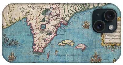
1591 De Bry and Le Moyne Map of Florida and Cuba
Paul Fearn
$42

1652 Merian Panoramic View or Map of Rome Italy
Paul Fearn
$42

1691 Sanson Map of the World on Hemisphere Projection
Paul Fearn
$42

1696 Coronelli Map of the Great Lakes
Paul Fearn
$42

1716 Homann Map of Ireland
Paul Fearn
$42

1747 La Feuille Map of Catalonia Spain
Paul Fearn
$42

1750 Homann Heirs Map of Israel Palestine Holy Land
Paul Fearn
$42

1762 Zannoni Map of Central America and the West Indies
Paul Fearn
$42

A truly fascinating 1772 map of the northwestern parts of North America by Robert de Vaugondy and T
Paul Fearn
$42

1772 Vaugondy Diderot Map of North America and the Northwest Passage
Paul Fearn
$42

1773 Bellin Map of the Cape of Good Hope Capetown South Africa
Paul Fearn
$42

1786 Bocage Map of Corinthia Sicyonia and Achaia in Ancient Greece
Paul Fearn
$42

1794 Anville Map of Europe in late Roman times
Paul Fearn
$42

1795 Bowles Pocket Map of London
Paul Fearn
$42

1799 Clement Cruttwell Map of England
Paul Fearn
$42

1799 Clement Cruttwell Map of Ireland
Paul Fearn
$42

1807 Buache Map of Boston Massachusetts
Paul Fearn
$42

Comparative Map or Chart of the Worlds Great Rivers
Paul Fearn
$42

1845 Chambers Map of Ancient Italy
Paul Fearn
$42

1846 Broadside of the Collect Pond New York and Steam Boat Five Points
Paul Fearn
$42

1848 Land Survey Map of Florida
Paul Fearn
$42

1852 Davies Case Map or Pocket Map of London
Paul Fearn
$42

1852 Levasseur Map of the Department De La Vendee France Fiefs Vendeens Wines
Paul Fearn
$42

1853 US Coast Survey Map of the Western Florida Panhandle
Paul Fearn
$42

1855 Colton Map of Denmark
Paul Fearn
$42

1873 Asher Adams Map of the Midwest Ohio Indiana Illinois Missouri Kentucky
Paul Fearn
$42

1929 USGS Map of Grand Teton National Park Wyoming
Paul Fearn
$42

1670 Ogilby Map of West Africa Gold Coast Slave Coast Ivory Coast
Paul Fearn
$42

1742 Homann Heirs Map of Italy
Paul Fearn
$42

We've shipped over 1 million items worldwide for our 500,000+ artists. Each purchase comes with a 30-day money-back guarantee.